|
Photos
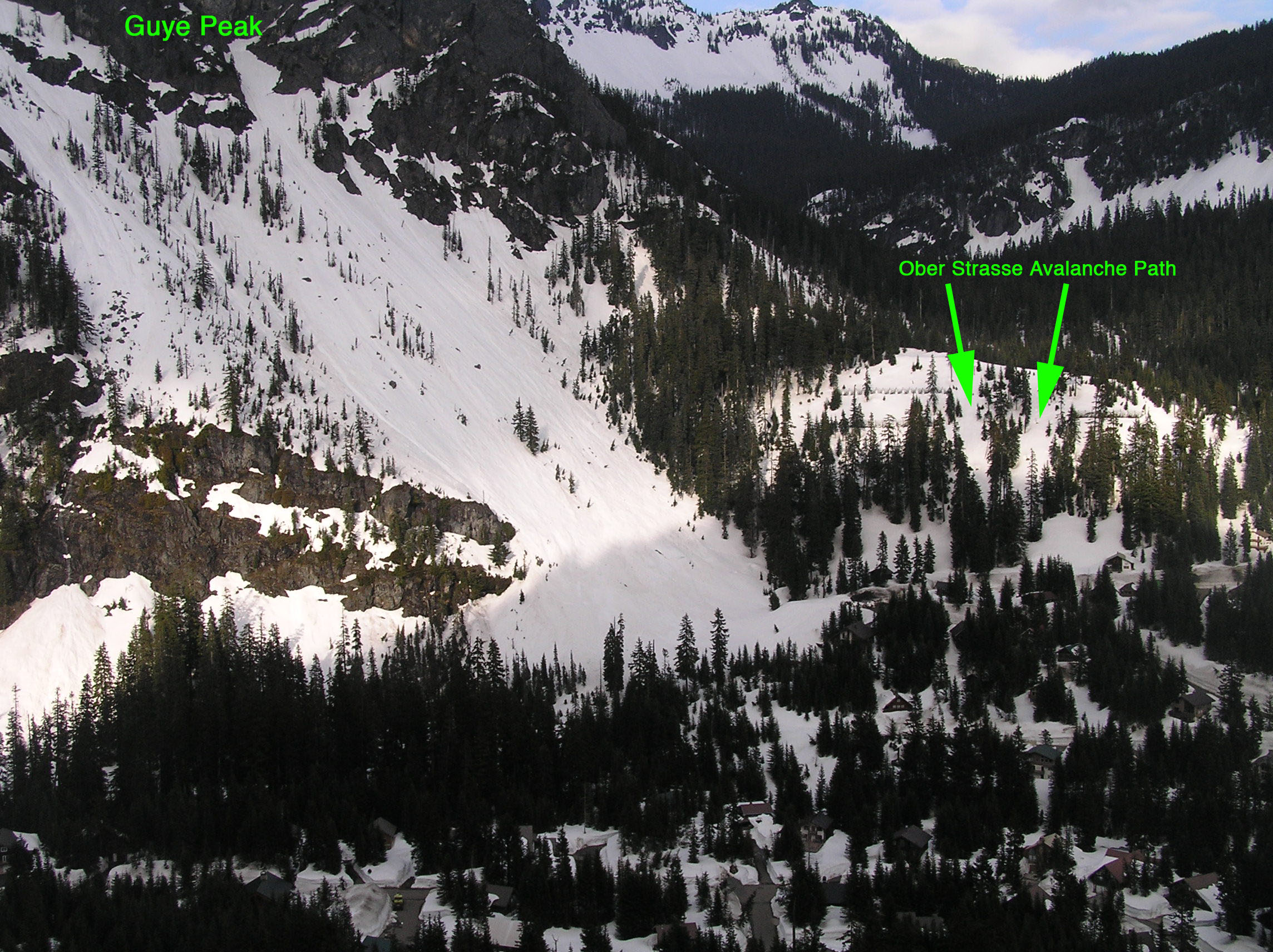
This photo was taken on May 4, 2008 with
approximately 100 inches of snowpack on the Snoqualmie Pass
D.O.T. weather plot. This photo shows that the
path is actually comprised of a North and a South starting
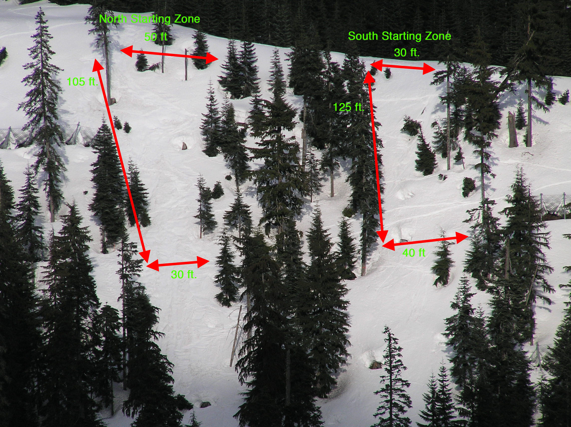
zone. The estimated dimensions of
the potential starting zones are outlined.
These are relatively small starting zones and at 100
inches of snow depth many trees are still visible as well as
numerous stumps within the zones.
The South starting zone is not quite as steep as the
North starting zone and not quite as wide at the top. It
would most likely take a slightly deeper snowpack depth to
overcome the anchors in the south starting zone in order for
it to initially release. Both starting zones, if they were to release and reach the road, would
end up depositing snow relatively in the same area of Ober
Strasse.
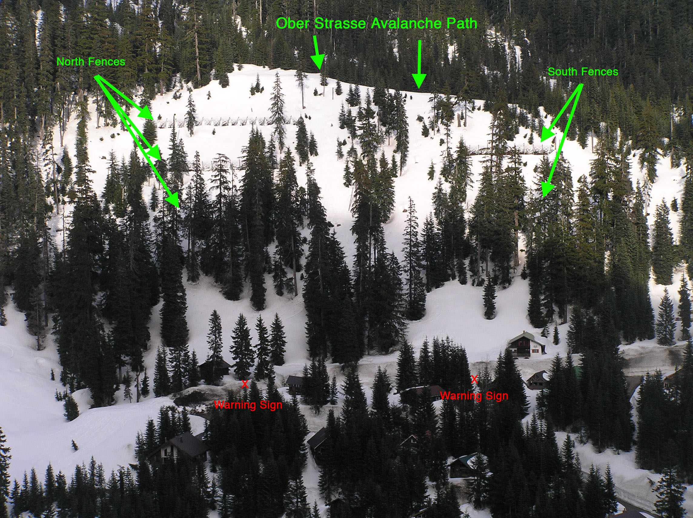
This photo shows the protective avalanche
fences, which were put in place in 1999. It
also shows the remaining path in between the north and south
fences. The location of the two
avalanche warning signs along Ober Strasse road is also
noted. The length of roadway
between these two signs is the area which would potentially be
affected by slide debris if this path were ever to release and
run to the road. This path is relatively
small being thirty to fifty feet wide at the top of its two
starting zones. The vertical distance from the roadway to the top of
the starting zones is 300 vertical
feet.
|